The Prime Meridian is the line of 0° longitude.
It divides Earth into:
- Eastern Hemisphere
- Western Hemisphere

Every other longitude measurement (1°E, 45°W, 120°E…) is calculated from this line.
Today, it passes through Royal Observatory Greenwich in London.
But that wasn’t always the case.
There is a thin metal strip in the ground at the Royal Observatory Greenwich. Tourists straddle it for photographs, one foot in the Eastern Hemisphere and the other in the Western. It looks ceremonial. Symbolic. Almost theatrical.
But that line represents one of the most consequential agreements in human history.
It marks zero degrees longitude — the Prime Meridian — the reference from which every location east or west is measured. It is the quiet backbone of global maps, time zones, navigation systems, aviation routes, and even your phone’s clock.
Yet for most of human history, zero did not exist.
The Earth turned. Ships sailed. Cities traded. But there was no shared starting point. No agreed reference. Every civilization defined its own “center.”
To understand why that matters, you have to imagine a world before coordination.
Before Zero — A Fragmented Planet
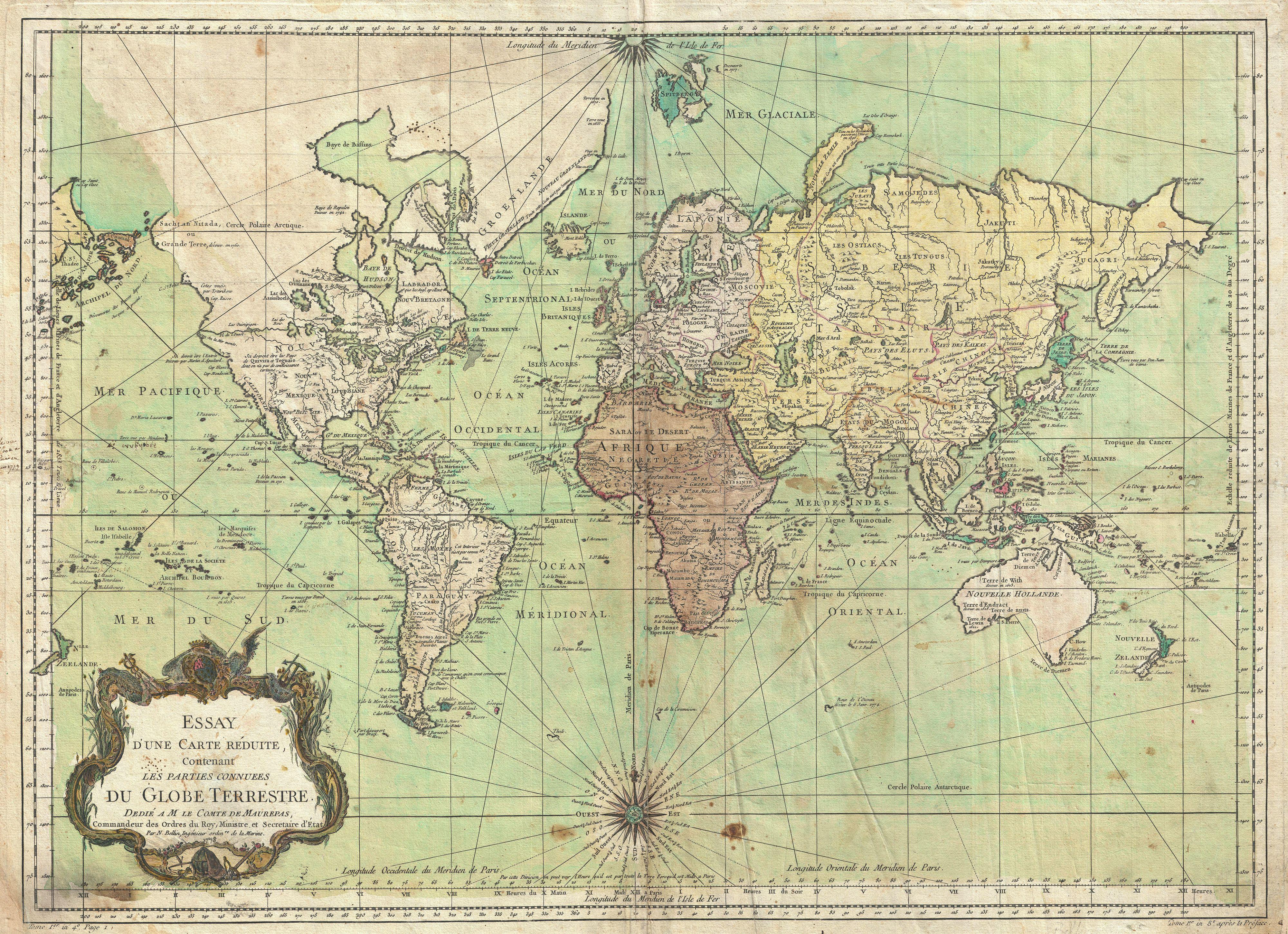
Before the late nineteenth century, countries chose their own prime meridians. France measured from Paris. Spain used Madrid. Some maps referenced Rome. Others used Ferro in the Canary Islands. There was no universal agreement.
If you compared maps from different nations, they didn’t align perfectly. They were internally consistent, but globally disjointed. It was as though each civilization insisted the world began at its own doorstep.
Latitude was relatively easy to measure — sailors could use the sun or stars. But longitude was the true puzzle. Without accurate longitude, ships miscalculated positions and wrecked on unseen shores. Entire fleets disappeared because they could not determine how far east or west they had drifted.
Longitude was not just a cartographic inconvenience. It was a matter of survival.
And the key to solving it was not geometry.
It was time.
Time as a Measuring Tool
The Earth rotates 360 degrees in 24 hours. That means it turns 15 degrees every hour. If you know the exact time at a reference location — and compare it to your local time — you can calculate your longitude.
But that requires extraordinary precision.
In the eighteenth century, an English clockmaker named John Harrison built marine chronometers accurate enough to keep time during long sea voyages. His innovation transformed navigation. For the first time, longitude could be calculated reliably at sea.

Yet there was still a missing piece.
Accurate timekeeping is meaningless without a shared reference time.
If every nation keeps time from a different meridian, then even perfect clocks cannot synchronize the world.
Humanity had learned how to measure longitude. Now it had to decide where longitude begins.
The Conference That Chose the World’s Zero
In 1884, delegates from twenty-five nations gathered in Washington, D.C. for what would become known as the International Meridian Conference.
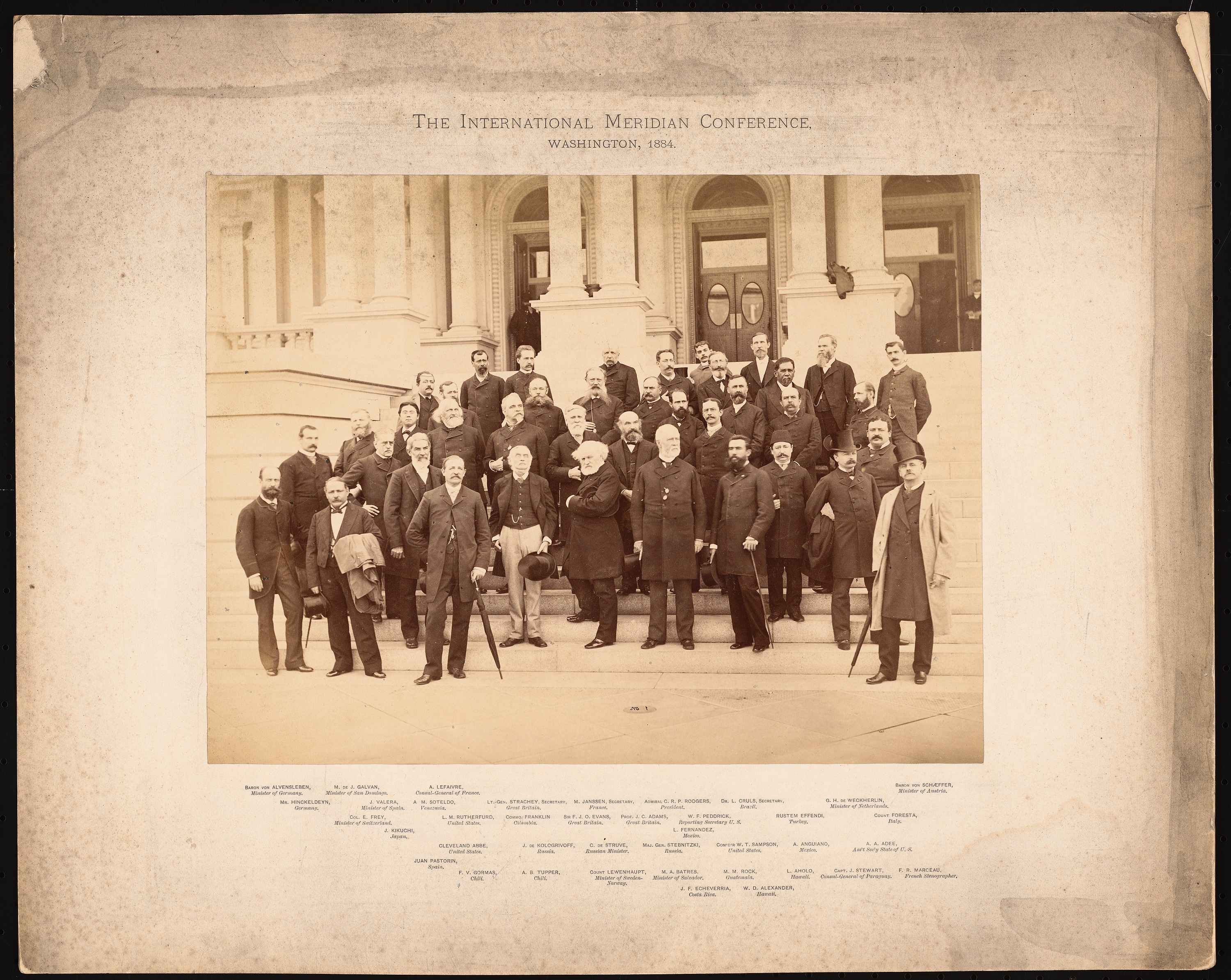
Their task was deceptively simple: choose a single prime meridian for the world.
By that time, most global shipping already relied on British nautical charts, which used Greenwich as their reference. The British Empire dominated international trade routes. Its navy was unmatched. Its maps were widely distributed.
When the vote was cast, Greenwich was selected.
This decision was presented as technical and scientific. But it was also political. The location of zero reflected global power structures of the nineteenth century. Measurement, like language and currency, follows influence.
From that moment forward, the meridian passing through Greenwich became the world’s official zero.
And with that agreement, the planet became synchronized.
From Longitude to Time Zones
The Prime Meridian did more than organize maps. It reorganized time itself.
Before global standardization, cities kept local solar time. Noon was when the sun reached its highest point in the sky. That meant neighboring towns could differ by minutes. In an agricultural world, this was manageable.
But the industrial age shattered that simplicity.
Railways required precise scheduling. Telegraph networks transmitted messages across continents in seconds. Financial markets demanded coordination. A train arriving “at noon” meant nothing if every station defined noon differently.
The solution was to divide the world into time zones, each offset from zero degrees longitude. Greenwich Mean Time became the reference. Later, this evolved into Coordinated Universal Time (UTC), which still uses the Prime Meridian as its spatial anchor.
Your phone’s clock. International flights. Satellite systems. Internet servers. All depend on synchronized time zones derived from that single decision.
Without a shared zero, modern civilization would fracture into temporal confusion.
A Line That Is Not Actually a Line
There is an irony here.
The line tourists stand on in Greenwich is symbolic. Modern satellite measurements show that the true zero longitude, defined by today’s geodetic systems, lies slightly east of the historic marker. Earth is not perfectly symmetrical. Its gravitational field is uneven. The reference we use today is based on a mathematically optimized global model.
In other words, the Prime Meridian has evolved.
But the concept remains.
The power of the Prime Meridian is not its physical exactness. It is the agreement behind it.
Civilization runs on shared conventions. Money has value because we agree it does. Borders exist because we recognize them. Time zones function because we coordinate them.
The Prime Meridian is one of humanity’s most profound conventions — a chosen reference point imposed on a rotating planet.
The Deeper Meaning of Zero
At first glance, the Prime Meridian appears to be geography. A technicality. A cartographic baseline.
But at a deeper level, it represents something more abstract.
It represents the human impulse to standardize reality.
Measurement is not merely scientific. It is civilizational. When we define units, references, and coordinates, we create a shared framework for action. Ships navigate safely. Engineers build precisely. Economies synchronize. Communications align.
The Prime Meridian is a reminder that the modern world depends less on raw power and more on coordinated systems.
The Earth spins regardless of what we choose. But civilization advances when we choose together.
In 1884, humanity did not move the planet. It moved itself — toward alignment.
A thin strip of metal in London marks that decision. Not because London is the center of the world. Not because Greenwich is inherently special.
But because for the first time, the world agreed that zero must exist somewhere.
And in choosing that somewhere, we transformed a rotating sphere into a synchronized civilization.